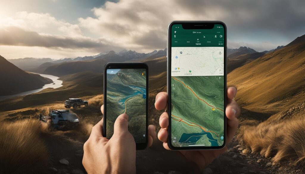
Are you ready for an off-road adventure like no other? Whether you’re a seasoned overlander or just getting started, Gaia GPS is here to revolutionize your navigation experience. Say goodbye to outdated paper maps and hello to the power of digital technology. With Gaia GPS, exploring the great outdoors has never been easier.
Imagine having a comprehensive guide in the palm of your hand, guiding you through uncharted territories with ease. Gaia GPS offers a range of features that cater specifically to overlanding adventures. From planning and mapping routes to marking waypoints and recording tracks, this app has it all. It’s like having a navigation expert right by your side, every step of the way.
Intrigued? Curious to learn more about how Gaia GPS can enhance your overlanding trips? Join me as we dive into the world of Gaia GPS and unravel the secrets to successful off-road exploration.
Key Takeaways:
- Gaia GPS is a powerful navigation tool for overlanding adventures.
- It offers a range of features for planning, mapping, and navigating off-road routes.
- With Gaia GPS, you can import tracks, mark waypoints, and record your own tracks.
- The app provides a variety of map layers to enhance your navigation experience.
- Gaia GPS is user-friendly and offers offline map capabilities.
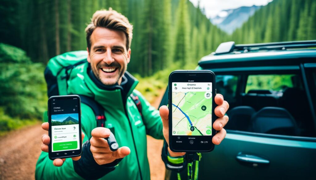
Gaia GPS is a powerful tool for overlanders, providing a seamless experience in discovering and creating routes for your adventures. With its comprehensive features and user-friendly interface, Gaia GPS allows you to explore new areas and plan your routes with ease.
Exploring New Areas with Gaia GPS
Using Gaia GPS, you can dive into uncharted territories and find potential areas to explore. By studying maps and satellite images, you’ll gain a better understanding of the terrain, allowing you to make informed decisions about your route choices.
Whether you’re looking for scenic trails, challenging off-road tracks, or hidden gems, Gaia GPS equips you with the tools to venture into new areas confidently.
Finding Potential Areas to Explore
Gaia GPS provides access to a plethora of maps and map layers, allowing you to uncover potential areas for exploration. Discover hidden trails, campgrounds, points of interest, and more with the help of Gaia GPS’s extensive map library.
Whether you prefer topographic maps, satellite imagery, or specialized layers like USFS Roads and Trails or NatGeo, Gaia GPS has the right map layers to suit your needs. This wealth of information will aid you in finding the perfect spots for your overlanding journey.
Creating Routes with Gaia GPS Route Planner
Gaia GPS’s route planner feature empowers you to create customized routes tailored to your preferences. With just a few clicks, you can plot your journey, add waypoints, and adjust the length of segments to optimize your route.
Whether you’re planning a long-distance overlanding trip or a shorter off-road adventure, Gaia GPS’s route planner provides the flexibility to design your ideal route, ensuring an unforgettable experience.
Adding Waypoints and Taking Photos
When using Gaia GPS, you can easily add waypoints to your imported tracks or created routes. These waypoints serve as markers for important locations, points of interest, or areas that require further exploration.
But the versatility of Gaia GPS doesn’t end there. You can also take photos along the way and use them as waypoints, adding visual context to your routes. Taking snapshots of breathtaking views, unique landmarks, or memorable moments is a breeze with Gaia GPS.
Recording Tracks and Downloading Map Layers
Recording your own tracks with Gaia GPS allows you to have an accurate record of your journey. By following an imported track or creating your own, Gaia GPS captures your path, ensuring you can retrace your steps or share your adventure with others.
Additionally, Gaia GPS enables you to download map layers for offline use. This feature ensures that you have access to important maps even in areas with limited or no cellular coverage, making Gaia GPS an invaluable tool in remote locations.
| Key Features | Benefits |
|---|---|
| Explore new areas and find potential locations to explore | Expand your horizons and embark on exciting overlanding adventures |
| Create customized routes with Gaia GPS’s route planner | Design your ideal journey tailored to your preferences |
| Add waypoints and take photos along the way | Mark important locations and capture memorable moments |
| Record tracks and have an accurate record of your journey | Ensure you never miss a moment and can retrace your steps |
| Download map layers for offline use | Stay connected even in areas with limited or no cellular coverage |
Importing Tracks with Gaia GPS
Gaia GPS offers a seamless process for importing tracks from a variety of sources, allowing users to enhance their overlanding experience. By importing tracks, users can access pre-existing routes, explore new areas, and maximize their navigation capabilities. Let’s explore the steps involved in importing tracks with Gaia GPS.
Finding GPX Tracks for Gaia GPS
To import tracks into Gaia GPS, users need to find GPX files from reliable sources. These files can be obtained from free and subscription-based websites, forums, and track sharing platforms. It’s important to ensure the accuracy and reliability of the tracks before importing. Once the GPX files are downloaded, we can proceed with the importing process in Gaia GPS.
Importing GPX and KML Files in Gaia GPS
To import GPX and KML files into Gaia GPS, follow these simple steps:
- Open Gaia GPS app on your device
- Click on the “Menu” icon to access the options
- Select “Tracks” from the menu
- Tap on the “+” symbol to add a new track
- Choose the option to import the track
- Navigate to the location where the GPX or KML file is stored
- Select the file and confirm the import
Reviewing Imported Tracks in Gaia GPS
Once the tracks are successfully imported, users can review them within Gaia GPS. The app provides a clear visualization of the imported tracks on the map interface. Users can zoom in and out, pan across the map, and examine the details of the imported tracks. This allows for a comprehensive understanding of the routes and aids in planning for the journey ahead.
Mapping Out Waypoints Along Imported Tracks with Gaia GPS
One of the key benefits of importing tracks with Gaia GPS is the ability to map out waypoints along the routes. Waypoints serve as critical points of interest, such as camping spots, viewpoints, water sources, or emergency exit points. By mapping out these waypoints, users can create a detailed plan for their journey, ensuring a safe and enjoyable overlanding experience.
Creating Camping Choices and Exit Points with Gaia GPS
When importing tracks, users can strategically map out camping choices and exit points for emergencies. This level of planning adds an extra layer of safety and convenience to the overlanding adventure. Gaia GPS makes it easy to create and label these camping choices and exit points, ensuring that they are easily identifiable and accessible during the journey.
Marking New Waypoints While on the Trail with Gaia GPS
In addition to importing existing tracks, Gaia GPS allows users to mark new waypoints while on the trail. This feature is particularly useful for discovering new points of interest or adjusting the route in real-time. By simply tapping on the current location and adding a waypoint, users can effortlessly track their progress and capture important moments during the overlanding adventure.
With Gaia GPS, importing tracks is a game-changer for overlanders. It provides access to a wide range of routes and routes modification options, optimizing the entire journey from planning to execution. By utilizing the full potential of Gaia GPS, users can embark on unforgettable overlanding adventures with confidence and ease.
Marking/Creating New Waypoints with Gaia GPS
Gaia GPS offers a seamless process for marking or creating new waypoints while on the trail, making navigation during your overlanding adventure a breeze. By simply tapping the (+) symbol on the toolbar, you can easily add waypoints and drag them to your desired locations. This feature allows you to accurately mark points of interest, potential campsites, or any other important landmarks along your route.
One exciting feature of Gaia GPS is the ability to use photos as waypoints. When you come across a breathtaking view or a memorable spot, simply take a photo and use it as a waypoint in Gaia GPS. This feature not only adds visual references to your routes but also serves as a way to relive those special moments when you review your trip.
Organizing your waypoints is a crucial aspect of efficient navigation, and Gaia GPS provides you with the tools to do so. You can easily name your waypoints, allowing you to quickly identify and reference them later. Furthermore, you can create folders within Gaia GPS to organize your data, ensuring that everything is neatly categorized and easily accessible.
Here’s an example of how you can organize your waypoints in Gaia GPS:
| Folder Name | Waypoint Name |
|---|---|
| Campsites | Campsite 1 |
| Campsite 2 | |
| Points of Interest | Waterfall |
| Historic Site |
By creating folders and organizing your waypoints in this way, you can easily find and reference specific locations on your trips, allowing for smoother and more enjoyable overlanding experiences.
With Gaia GPS, adding new waypoints, using photos as waypoints, and organizing your data has never been easier. Now you can navigate your overlanding adventures with confidence and ensure that you never miss an important location along the trail.
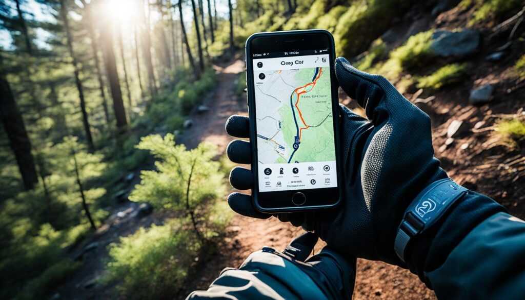
Recording Tracks with Gaia GPS
Recording tracks is a crucial feature of Gaia GPS for overlanders like me. It allows us to document our journeys and keep track of changes in routes and waypoints. With Gaia GPS, I can explore uncharted terrain confidently, knowing that I have a comprehensive record of my adventures.
When it comes to recording tracks, Gaia GPS offers a variety of map layers, each tailored to different needs. One of my preferred map layers is Gaia Topo. It provides detailed information and serves as a low overhead map layer that doesn’t consume excessive device resources. With Gaia Topo, I can navigate through challenging terrains with ease.
But that’s not all! Gaia GPS also provides a wealth of data with each recorded track. This includes information such as distance traveled, elevation changes, average speed, and more. Having access to this data allows me to analyze my progress, identify areas for improvement, and make informed decisions about my routes.
For exploring new areas or finding alternative routes, Gaia GPS offers a range of preferred map layers. These include USFS 2016, USFS Trails and Roads, and NatGeo. These map layers provide valuable information about trails, roads, and topographic features, ensuring that I have the most accurate and up-to-date information while exploring.
| Preferred Map Layers for Recording Tracks and Exploring in Gaia GPS |
|---|
| Gaia Topo |
| USFS 2016 |
| USFS Trails and Roads |
| NatGeo |
With Gaia GPS, I can confidently explore new territories, record my tracks, and rely on accurate mapping data to guide my adventures. Whether it’s marking waypoints, analyzing data, or finding the best routes, Gaia GPS is a versatile tool that every overlander should have in their arsenal.
Gaia GPS for Snow Season and Off-Road Travel
Gaia GPS is a versatile navigation tool that goes beyond just overlanding. It also caters to users who enjoy snow season activities and off-road travel. With its comprehensive features and user-friendly interface, Gaia GPS is the perfect companion for your winter adventures and off-road explorations.
Winter Base Map for Snow Season
When it comes to navigating the snowy terrain, Gaia GPS has you covered with its winter base map specifically designed for snow activities. This map provides valuable information such as ski resort details, snow conditions, and Nordic trails to ensure a safe and enjoyable experience on the slopes.
Ski Resort Information and Nordic Trails
Planning a trip to a ski resort? Gaia GPS offers comprehensive ski resort information, including trail maps and amenities, so you can make the most of your time on the mountain. Additionally, the app provides detailed maps of Nordic trails, empowering cross-country skiers to explore the winter wonderland with confidence.
Route Planning for Road Trips
Gaia GPS is not just limited to off-road adventures; it is also a valuable tool for planning road trips. With its robust route planning features, you can easily create and customize your ideal road trip itinerary. Whether you’re exploring scenic routes or discovering new cities, Gaia GPS will help you navigate every step of the way.
GPS Navigation Tools for Off-Road Travel
Off-road travel requires reliable navigation tools, and Gaia GPS delivers. With its advanced GPS capabilities, you can confidently venture into uncharted territory, knowing that you have accurate and up-to-date navigation data at your fingertips. Gaia GPS provides real-time tracking, waypoints, and intuitive map layers to help you navigate rugged terrain and find your way back.
Integration with Apple Car Play
Gaia GPS seamlessly integrates with Apple Car Play, allowing you to display maps and access navigation features directly on your car’s dashboard screen. This integration ensures a safer and more convenient driving experience, with turn-by-turn directions right in your line of sight.
Unlocking Premium Features
While Gaia GPS offers a range of powerful features for free, upgrading to the premium version unlocks even more capabilities. With the premium version, you can enjoy enhanced map layers, additional waypoints, advanced route planning tools, and priority access to new features and updates. Upgrade today to take your snow season and off-road adventures to the next level.
Gaia GPS Premium Features Comparison
| Free Version | Premium Version |
|---|---|
| Access to basic map layers | Enhanced map layers, including winter base map |
| Limited waypoints | Unlimited waypoints for detailed route planning |
| Basic route planning tools | Advanced route planning tools, including turn-by-turn directions |
| Standard updates and features | Priority access to new features and updates |
Conclusion
Gaia GPS is a versatile and powerful tool that is a must-have for overlanding, snow season, and off-road travel. With its wide range of features and capabilities, this app serves as an invaluable companion for outdoor adventures.
Whether you’re exploring new areas, following imported tracks, or creating your own routes, Gaia GPS provides the necessary tools for successful navigation. The route planning feature allows you to chart your course with ease, while marking waypoints ensures you never miss important locations along the way. And with the ability to record tracks and access offline maps, you can confidently venture into remote areas without worrying about connectivity.
One of the highlights of Gaia GPS is its user-friendly interface, making it accessible to both beginners and seasoned outdoor enthusiasts. Additionally, the app offers a wide range of map layers, including Gaia Topo, USFS Roads and Trails, and NatGeo, allowing you to choose the most suitable map layer for your specific needs.
For those looking to enhance their navigation experience even further, upgrading to the premium version of Gaia GPS unlocks additional features and functionalities. With Gaia GPS, you can elevate your overlanding, snow season, and off-road travel adventures to new heights.
FAQ
How can Gaia GPS help with overlanding?
Gaia GPS is a powerful navigation tool that offers a range of features to enhance your overlanding adventures. It allows you to discover and create routes, import tracks from various sources, mark or create new waypoints, and record your own tracks. With its user-friendly interface and offline map capabilities, Gaia GPS is the go-to app for successful overlanding trips.
How do I discover and create routes with Gaia GPS?
Gaia GPS allows you to study maps and satellite images to find potential areas to explore. You can use the route planner feature to create customized routes by adding waypoints and adjusting segment length. Imported tracks can also be marked with new waypoints, and you can even use photos as waypoints. To ensure offline access, you can download map layers for your desired areas.
How do I import tracks with Gaia GPS?
Gaia GPS allows you to import tracks from various sources, such as free and subscription-based websites, forums, and track sharing platforms. Simply import the GPX or KML files into Gaia GPS and review them for planning purposes. You can map out waypoints along the imported tracks, creating camping choices and exit points for emergencies. You can also mark new waypoints while on the trail to ensure you don’t miss any points of interest.
How do I mark or create new waypoints with Gaia GPS?
Marking or creating new waypoints with Gaia GPS is simple. Just tap the (+) symbol on the toolbar and add waypoints by dragging them to the desired locations. You can also take photos and use them as waypoints, adding visual references to your routes. Gaia GPS allows you to name waypoints, choose folders for organization, and even make waypoints public or private. Create folders to keep your data organized and dedicated to specific tracks or routes.
How do I record tracks with Gaia GPS?
Recording tracks with Gaia GPS is a key feature for overlanders. It allows you to document your journey and track changes in routes and waypoints. Gaia GPS offers a range of map layers for recording tracks, including Gaia Topo, USFS Roads and Trails, and NatGeo. These map layers provide detailed information and help you navigate uncharted terrain. Gaia GPS also provides a wealth of data with each recorded track, allowing you to analyze your progress and make adjustments if needed.
Can Gaia GPS be used for snow season and off-road travel?
Yes, Gaia GPS is not just limited to overlanding. It also caters to users who enjoy snow season and off-road travel. The app offers a winter base map specifically designed for snow activities, providing ski resort information and Nordic trails. With GPS navigation tools, you can confidently explore off-road routes and plan road trips. Gaia GPS also integrates with Apple Car Play, allowing you to display maps on your car’s dashboard for easy turn-by-turn directions. You can unlock additional features by upgrading to the premium version of Gaia GPS.